Fleet tracking software to monitor and manage your mobile workforce with confidence.
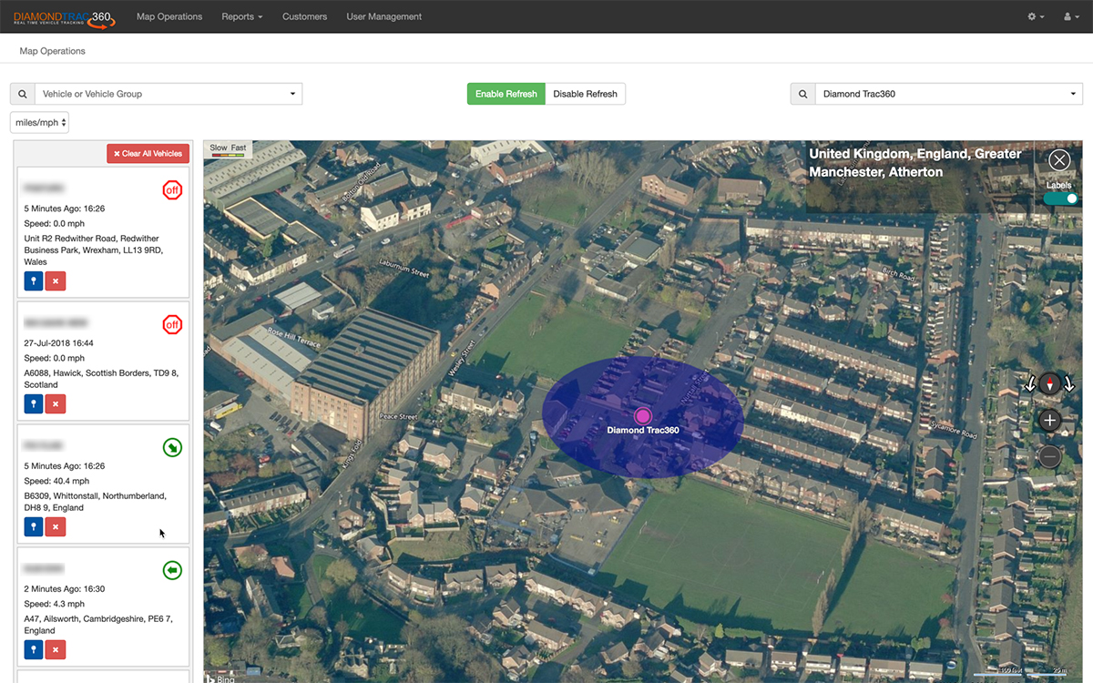
The Diamond Trac360 vehicle tracking system provides real-time vehicle information, empowering you to know the precise location of your fleet anytime, anywhere.
Our mapping updates every one minute giving you up to date locations of all of your fleet. If you can see it, you can manage it, if you can manage it you can make it better and make it stronger.
Recent advancements in technology have changed our lives; we live in a mobile-first world where business is managed and monitored on the go, controllable directly from your smart phone.
So it made perfect sense for us to create apps for iPhone and Android, making our vehicle tracking system available in the palm of your hand, wherever you are.
Features including street-level, satellite and hybrid mapping, vehicle search and journey reporting; our free phone app is clear and easy to use empowering our clients see the precise location and status of their fleet.

Our high resolution mapping offers five map styles to choose from, all giving pin point accuracy of your fleet location. There is no software to download; our mapping is available from any device with internet browser.
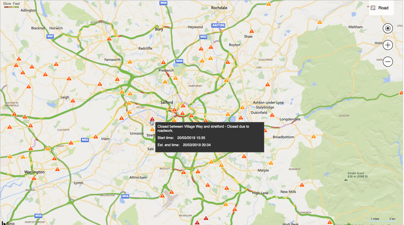
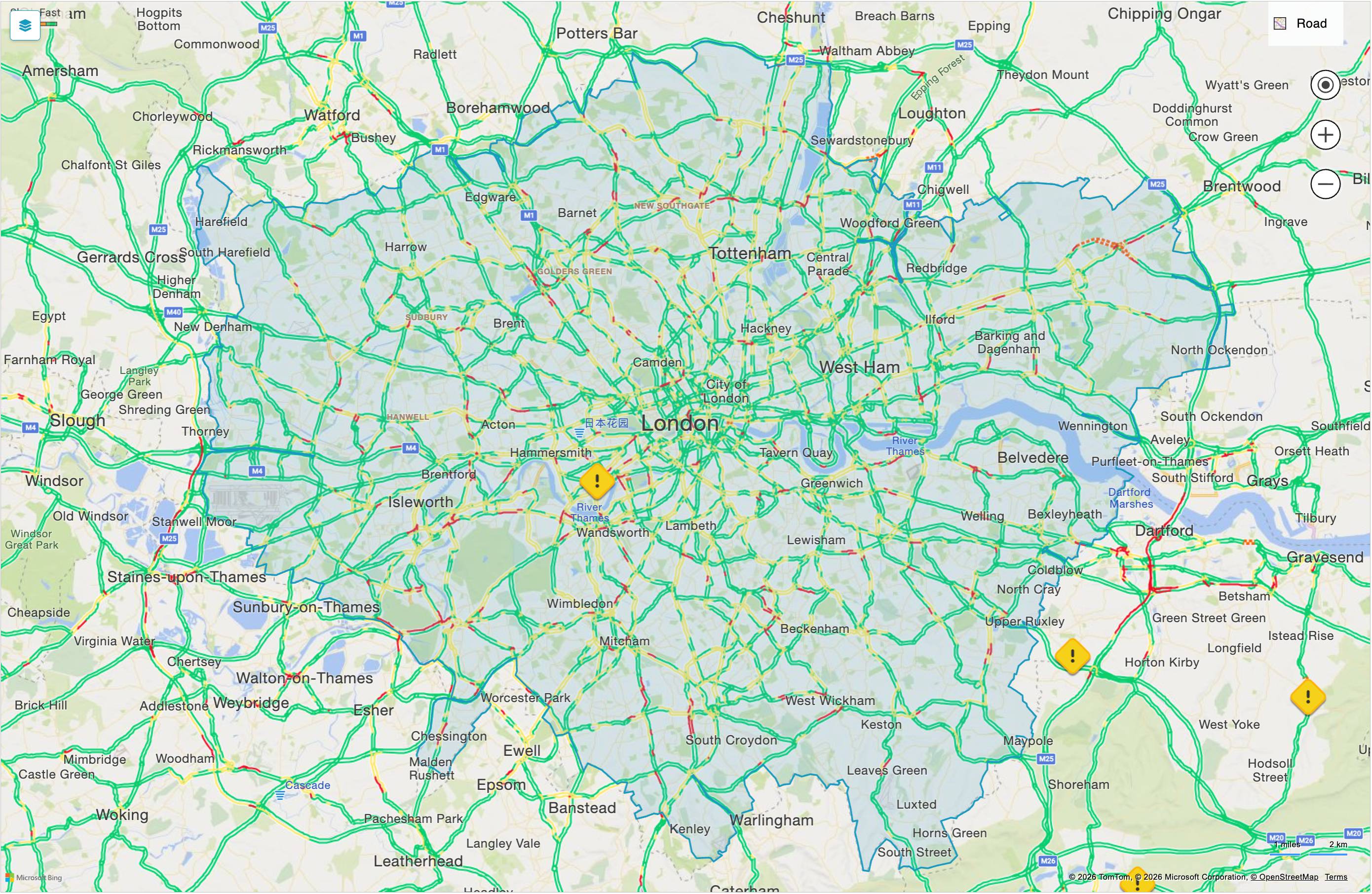
Smart, intelligent mapping that is constantly updating showing roadworks and road closures, and where there are accidents and delays. All invaluable information for any fleet operator that needs to plan ahead.
Toggle London's Direct Vision Standard zones on or off with a single click on the map. The overlay shows DVS boundaries as translucent shaded areas under your live vehicle positions, so you can see at a glance which vehicles are entering regulated zones and plan routes accordingly. Your preference is remembered between sessions.
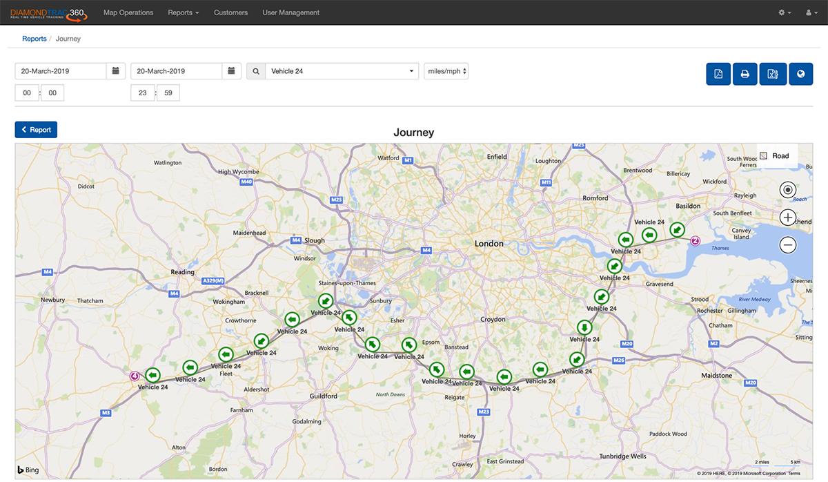
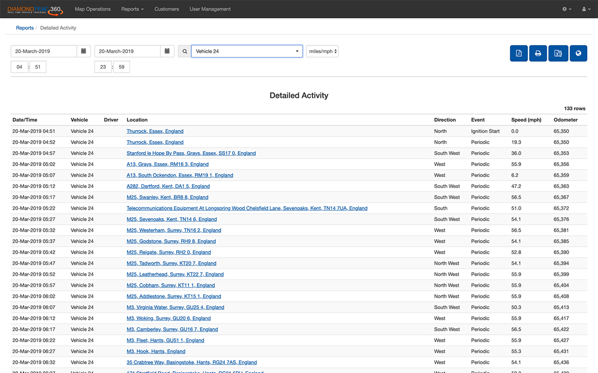
Our journey reporting feature enables you to review and learn from historical journeys. Available in formats that are easy to analyse and understand, journeys can be viewed in a tabular report or visualised in an interactive map showing a snail trail of the route taken.
Each way point provides additional information throughout the journey including the vehicle status, date and time, direction of travel and vehicle speed.
Using our snail trail feature will quickly show if routes are optimised and highlight suspicious activities, helping you to ensure routes are optimised to help reduce mileage and in turn reduce fuel costs.
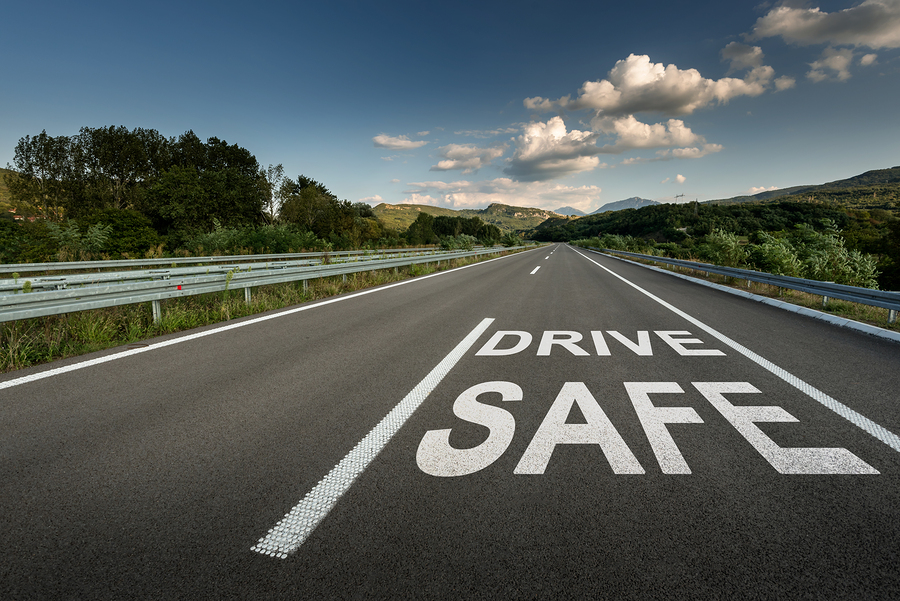
When duty of care is a top priority, our fleet tracking system helps you understand your drivers’ habits and make smart business decisions.
Our journey report and stop time report help you identify those at risk of driver fatigue and ensure adequate rest breaks are taken; and those breaks are taken for an adequate period of time.
Our exception reports identify habitual speeding, aggressive driving and excess idling; this knowledge can be used to change driver behaviour, to improve road safety, reduce vehicle maintenance costs, boost fuel efficiency and decrease your fleets carbon footprint.
Our reporting suite provides access to a range of information to help you run your fleet and operations better:
Our reports are interactive with the ability to search, filter and export data. Reports are also integrated with our mapping system, so with just one click report information can be displayed on a map showing exact location or even information.
Where companies have multiple business units, a mixed fleet of vehicles, diverse skillsets or dispersed geographical locations, our Vehicle Groups feature makes it possible to group vehicles into distinct sets enabling you to view specific vehicle clusters on mapping and also reports. Efficient vehicle selection and skill utilisation will help improve fleet productivity and improve planning.
Our custom points feature allows users to set up a virtual barrier around specific points of interest. It's useful to know that your vehicle did stop at certain location and also for how long. Users can add as many locations to the mapping as they need to, changing the name, the location and also the radius of the barrier via our vehicle tracking platform.
Custom point reports can then be viewed selecting labels for customers, drivers home addresses, barred locations or indeed preferred locations; such as truck stops/overnight parking and fuel stops. Whatever your need be to create a custom point it makes viewing vehicle historical data that little bit easier.
Each custom point can now be assigned a colour, so depots, customer sites, fuel stops and overnight parking are instantly recognisable on the map at a glance - no more clicking individual markers to identify them. The chosen colour tints both the pushpin and its radius circle.